 |
Latest release: 1.2.2 (21st September 2009)
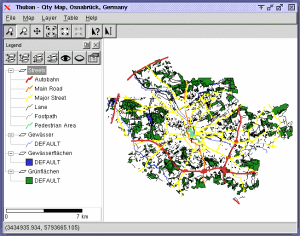
Thuban is an Interactive Geographic Data Viewer
with the following features:
- Vector Data Support: Shapefile, PostGIS Layer and OGR
- Raster Data Support: GeoTIFF Layer and GDAL
- Comfortable Map Navigation
- Object Identification and Annotation
- Legend Editor and Classification
- Table Queries and Joins
- Projection Support
- Printing and Vector Export
- API for Add-Ons (Extensions)
- Multi-Language Support:
English, French, German, Hungarian, Italian, Russian, Czech and Spanish
- User Manual (English)
Thuban is extensible and multi-platform (GNU/Linux,
Windows, ...).
It is Free Software under the GNU General Public License (GNU GPL).
2009/09/23
|
|


