 |
 |
 |
|
|
Why is Thuban being developed?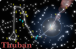 [2001:] The FreeGIS Project provides
an overview of Free Software GIS projects.
Many valuable and highly sophisticated tools exist, but there is
still a need for a user-friendly, interactive viewer for geographic
information.
[2001:] The FreeGIS Project provides
an overview of Free Software GIS projects.
Many valuable and highly sophisticated tools exist, but there is
still a need for a user-friendly, interactive viewer for geographic
information.
Thuban makes use of several Free GIS Software components and is itself the basis of advanced GIS applications, e.g GREAT-ER desktop The project name Thuban originates from the alpha-star in the constellation Draco, the Dragon. It was the pole star when the Egyptians built the pyramids. Read this WikiPedia article for more about the Thuban the star. There is also a short german article on Thuban at WikiPedia. CreditsLead DeveloperBernhard Herzog <bh@intevation.de>: all major concepts, Table-Management, many features.DevelopersJonathan Coles <jonathan@intevation.de>: Legend, Classification, Projection-Management, GDAL-Support, documentation.Nina Hüffmeyer: OGR extension. Frank Koormann <frank@intevation.de>: Various small features, some extensions, fixes, documentation, web pages. Martin Müller <martin@intevation.de>: OGC Simple Features for SQL for PostGIS. Russel Nelson: Some small features. Markus Rechtien: SVG export extension. Bernhard Reiter <bernhard@intevation.de>: Conceptual ideas, various small fixes. Martin "Joey" Schulze: Major improvements of the WMS extension and some other small improvements. Jan Schüngel: UMN MapServer Management extension. Jan-Oliver Wagner <jan@intevation.de>: Various small features, some extensions, fixes, documentation, web pages. Translation TeamFrench: Daniel Calvelo ArosGerman: Björn Broscheit <bjoern@intevation.de> Hungarian: Norbert Solymosi Italian: Maurizio Napolitano Portuguese (Brazilian): Eduardo Patto Kanegae Russian: Alex Shevlakov Spanish: Daniel Calvelo Aros Other contributorsJonathan Byron: Document improvements.Ole Rahn: Major parts of the contributed PIROL extension. Silke Reimer <silke@intevation.de>: Debian maintainer for Thuban. Lorenzo Moretti: MacOS X Port and Packaging of Version 1.0.1 AcknowledgementsThe development of basic Thuban features has been part of the project "GREAT-ER II - Georeferenced Regional Exposure Asessment Tool for European Rivers", the successor of GREAT-ER 1.0. The GREAT-ER II project and the first phase of Thuban has been contracted as part of the CEFIC Long Range Research Initiative.2005/07/08 |
|||
 |
 |
||
 |
 |
|||||||
| Info | ||||||||
|
||||||||
 |
 |
|||||||
|
|
|||||||
| News | ||||||||
|
Archive |
||||||||
|
|
|||||||
|
|
|||||||
| Exits | ||||||||
|
||||||||
|
|
|||||||
