1.3. The Main Window
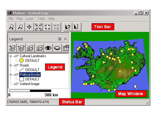
The map window shows the current state of the map and is where the user can interact with the map using the tools.
The legend on the left displays a list of the current layers and any visible classification groups. In the example, each shape layer has a default classification which specifies how the shapes in each layer are drawn. Layers that are higher in the list appear ``closer'' to the user. The legend can be closed by clicking on the small X in the upper right-hand region of the legend. To open it again, use ->. The legend is also dockable, which means that it can be detached from the main window by clicking on the small button next to the close button. It can be attached by clicking the same button again.
The status bar displays different information depending on the current context. If the user is selecting an item from the menu then the status bar will display a short help message indicating what each menu item is for. If the user has a tool selected then the position of the cursor on the map is displayed.
The tool bar provides quick access to the commonly needed tools. By hovering over each button the user can see a short messages describing what the tool does. The tools provided are Zoom In, Zoom Out, Pan, Full Extent, Full Layer Extent, Full Shape Extent, Identify, and Label. Each of the tools will be explained in further detail later in the manual.