Chapter 3. Map Management
The map consists of a number of layers where each layer represents a different type of data set. By interacting with the map the user can visually explore the data.
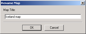
The map can have a name that will appear in the Thuban title bar. The map name can be changed using ->.
3.1. Adding and Removing Layers
There are three types of layers that can be added to a map: Shape layers, database layers and image layers. Shape layers are stored in Shapefile format, a widely used file format for storing geographic objects. These files have the extension ``.shp''. Associated with the shape file is a database file which stores attributes for each shape in the Shape file. This file, in dBase format, has the extension ``.dbf''. Both files must have the same base name. For example, if there is a shape file named roads.shp there must also be a file roads.dbf.
Shape layers can be added to the map with ->. Initially, only the ``.shp'' files are shown which is enough for the selection. However, if you switch to display all files and select one of the associated files (e.g. ``.dbf''), Thuban will recognize the base name and load the corresponding Shape file.
The file dialog for Shape files allows to select multiple files. Use the shift-button together with the left mouse button to extend the selection.
Database layers can be added to the map with ->. A dialog with two lists is opened. The left list displays all database connections currently open for the session. You can retrieve a list of available layers from the selected database which is displayed on the right hand. From this list one layer can be selected, the dialog is closed afterwards.
See appendix ``Working with PostGIS'' for details.
Image layers can be added to the map with ->. It is important to select a valid image file that has geographic data associated with it. The data can be embedded in the file itself, or in another file. If geographic information cannot be found, Thuban will report an error.